
Podcast: Play in new window | Download | Embed
Subscribe: Apple Podcasts | Email | RSS
Welcome to The Daily Wrap Up, a concise show dedicated to bringing you the most relevant independent news, as we see it, from the last 24 hours (6/13/19).
As always, take the information discussed in the video below and research it for yourself, and come to your own conclusions. Anyone telling you what the truth is, or claiming they have the answer, is likely leading you astray, for one reason or another. Stay Vigilant.
(https://d.tube/c/tlavagabond)

Bitcoin Donations Are Appreciated:
www.thelastamericanvagabond.com/bitcoin-donation
(3FSozj9gQ1UniHvEiRmkPnXzHSVMc68U9f)


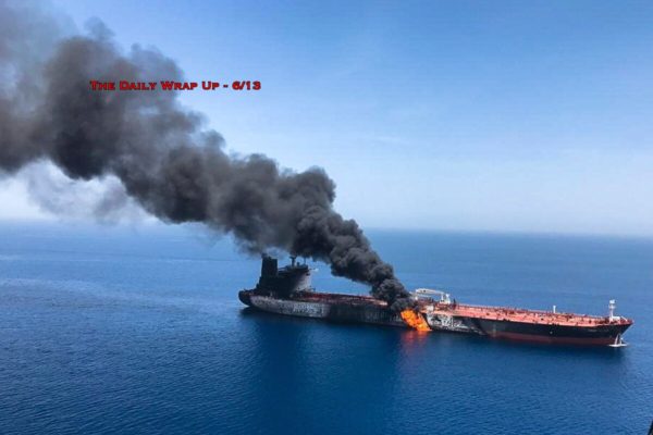
As for “American ships rushing in”, this can easily be dealt with
if they are actually displayed. One can take the name, translate
that to a ship type, and from that get their maximum speed. Then,
you know how long it would take them to get from A to B, and the
distance scale is shown in the MarineTraffic site in Km and Nm.
Simple.
“Several American vessels in the Area”. What? They dont have
good quality radar and other electronic information systems so
that they could have proven who was acting? (Oh, thats right,
“we dont reveal our methods”). Oh, and what about their Sat
imagery? Surely the US is tasking high precision imagery
over this area at the moment (in fact, why the hell not ALL
THE TIME, if this is such an imporant straight; they want to
know EVERYTHING about this stretch of water). Thus, no evidence
forthcoming is a serious admission of incompetence or involvement.
Dont forget that the first false flag we know about was also
a ship; USS Maine (spanish american war).